http://images.google.com/imgres?imgurl=http://proceedings.esri.com/library/userconf/proc00/professional/papers/PAP691/p6911.gif&imgrefurl=http://proceedings.esri.com/library/userconf/proc00/professional/papers/PAP691/p691.htm&usg=__xvXJRDNCLhratJEGzHL2Uc2k4U4=&h=322&w=260&sz=52&hl=en&start=23&um=1&tbnid=2JBE1V-hpoBkZM:&tbnh=118&tbnw=95&prev=/images%3Fq%3Ddigital%2Bline%2Bgraph%26ndsp%3D18%26hl%3Den%26client%3Dsafari%26rls%3Den%26sa%3DN%26start%3D18%26um%3D1
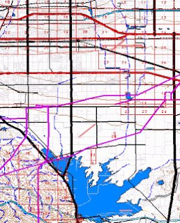
The DLG uses digital vector data. It can include a wide range of factors from topography to boundaries to roads. Map features are displayed by lines, points, and areas.
No comments:
Post a Comment