http://images.google.com/imgres?imgurl=http://www.weatherusa.net/blog/images/doppler-orlando-1943.gif&imgrefurl=http://www.weatherusa.net/blog/entry.php%3Fid%3D3&usg=__-NUqtz1shxwzixXfj-M8ey28U4M=&h=620&w=620&sz=51&hl=en&start=2&um=1&tbnid=-lqo28ggXCXHhM:&tbnh=136&tbnw=136&prev=/images%3Fq%3Ddoppler%2Bradar%26hl%3Den%26client%3Dsafari%26rls%3Den%26sa%3DG%26um%3D1
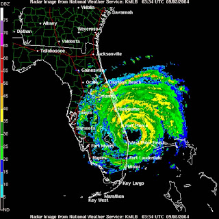
A doppler radar map uses microwaves to track direction and speed of suspended water in the atmosphere and determines the motion. This is a doppler radar of a hurricane over the west coast of Florida.
No comments:
Post a Comment